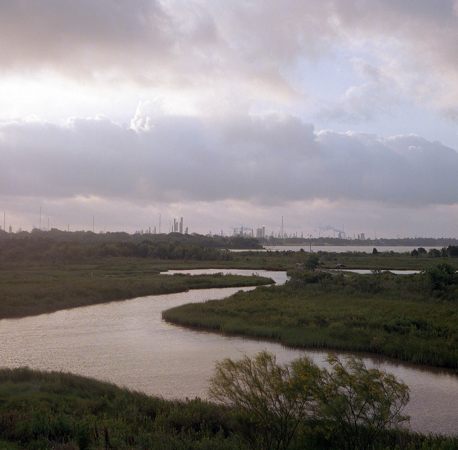
The city of Baytown, Texas, home to the sprawling ExxonMobil refinery and across the ship channel from the San Jacinto Monument, sits on a peninsula jutting southwest into the upper reaches of Galveston Bay. It once housed the picturesque Brownwood subdivision, where, beginning in the 1950s, executives of Humble Oil lived midcentury dreams of postwar affluence in a suburban paradise. Those dreams washed away in the 1960s and 1970s as the peninsula sank after repeated and increasingly severe flooding. Though residents of the Brownwood subdivision banded together and installed flood-avoidance infrastructure, the neighborhood continued to sink. In 1983, when Hurricane Alicia hit the area and once again devastated the subdivision, the federal government and the city used section 1362 of the National Flood Insurance Act to buy out the property owners. By way of a series of fortuitous events, the former Brownwood subdivision is now home to the Baytown Nature Center, a constructed wetlands area featuring tidal marshes, seabirds, and alligators.1
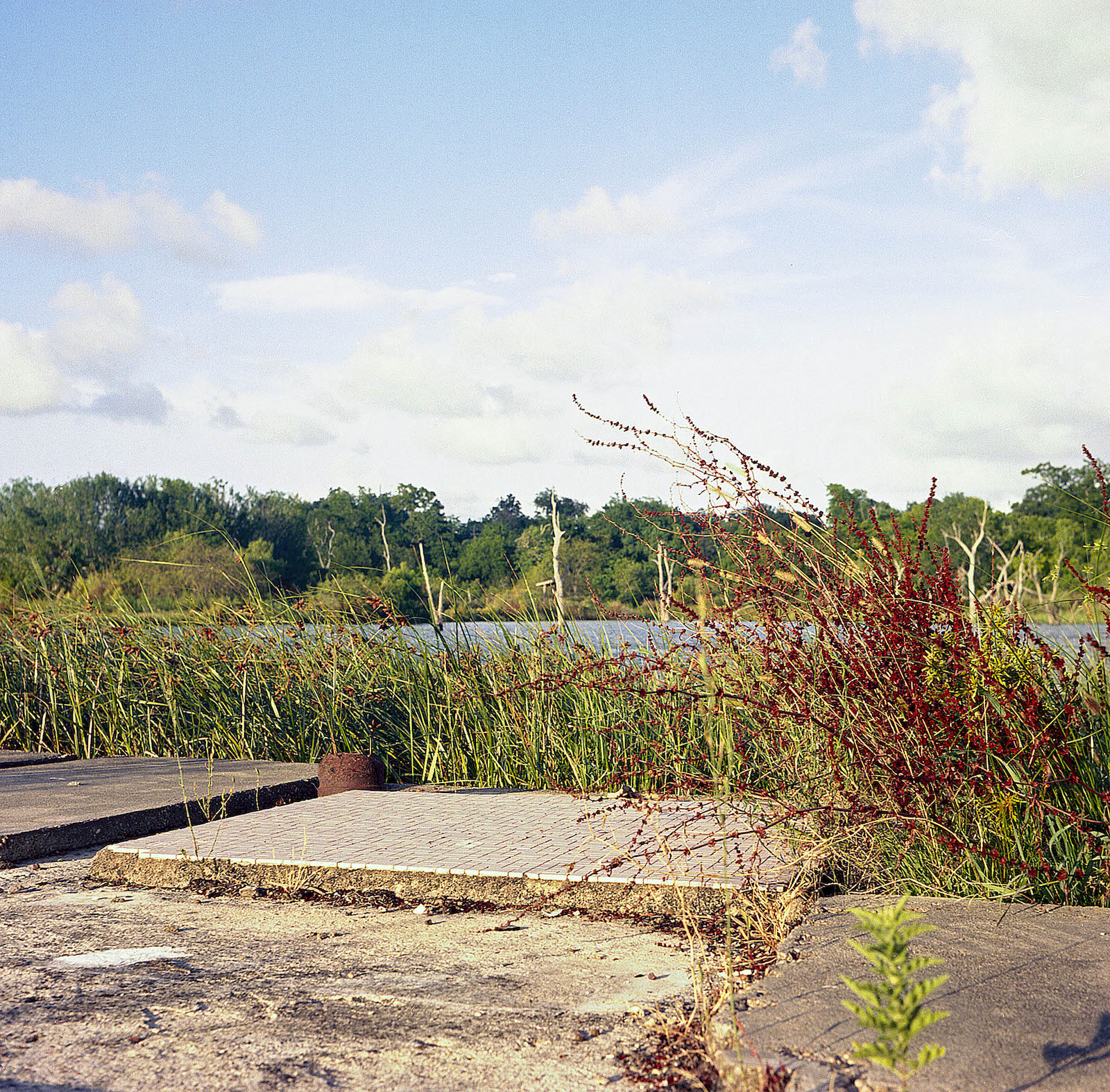
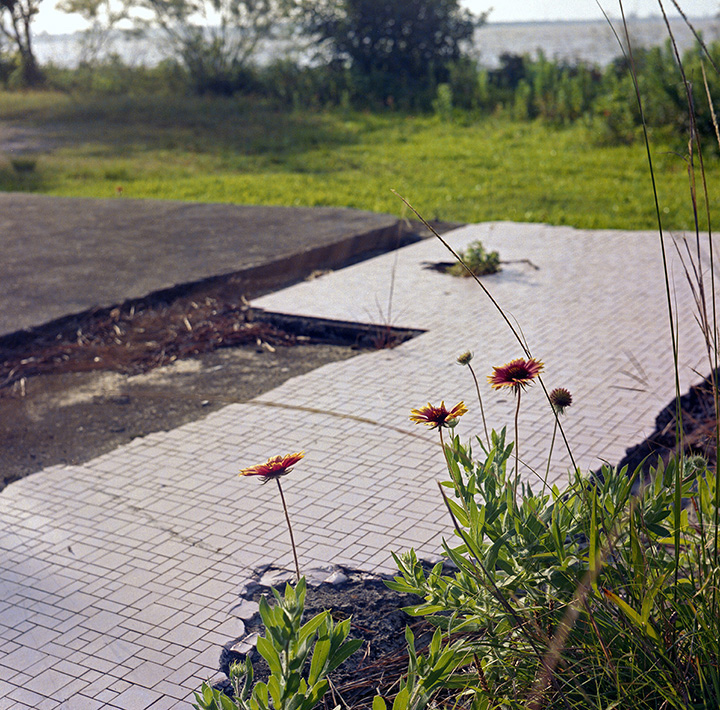
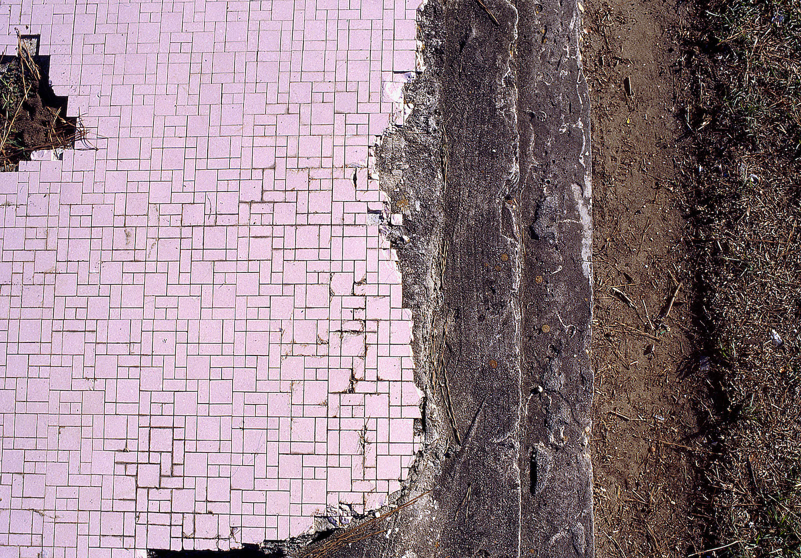
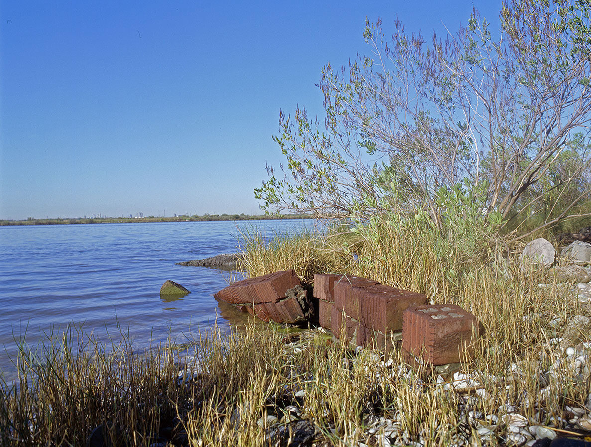
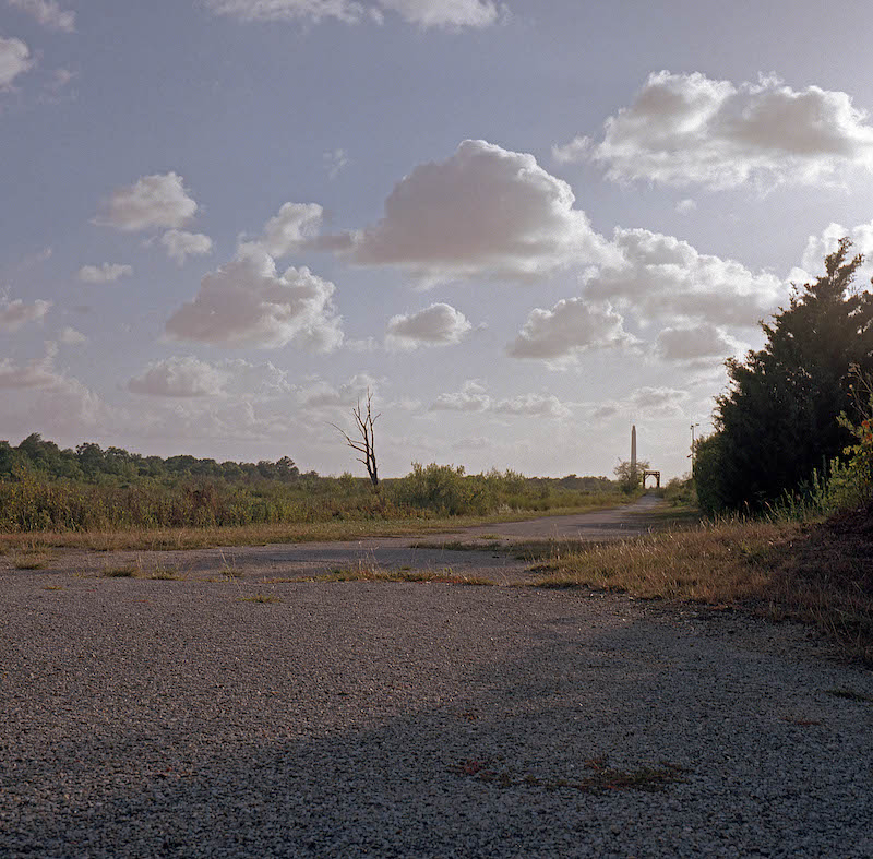
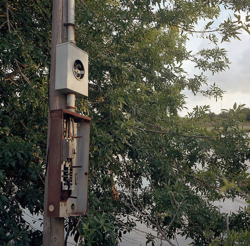
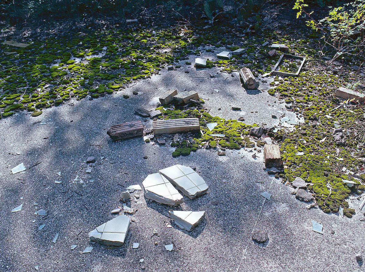
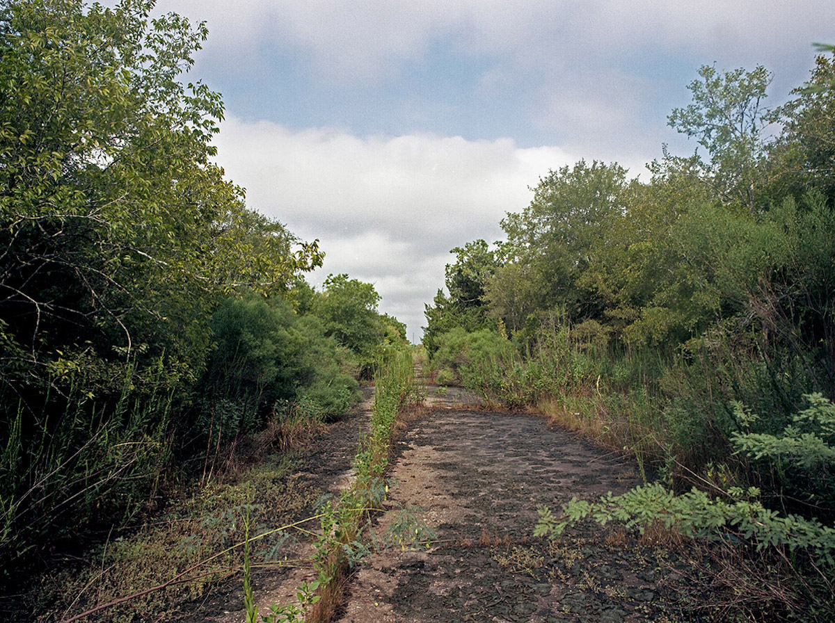
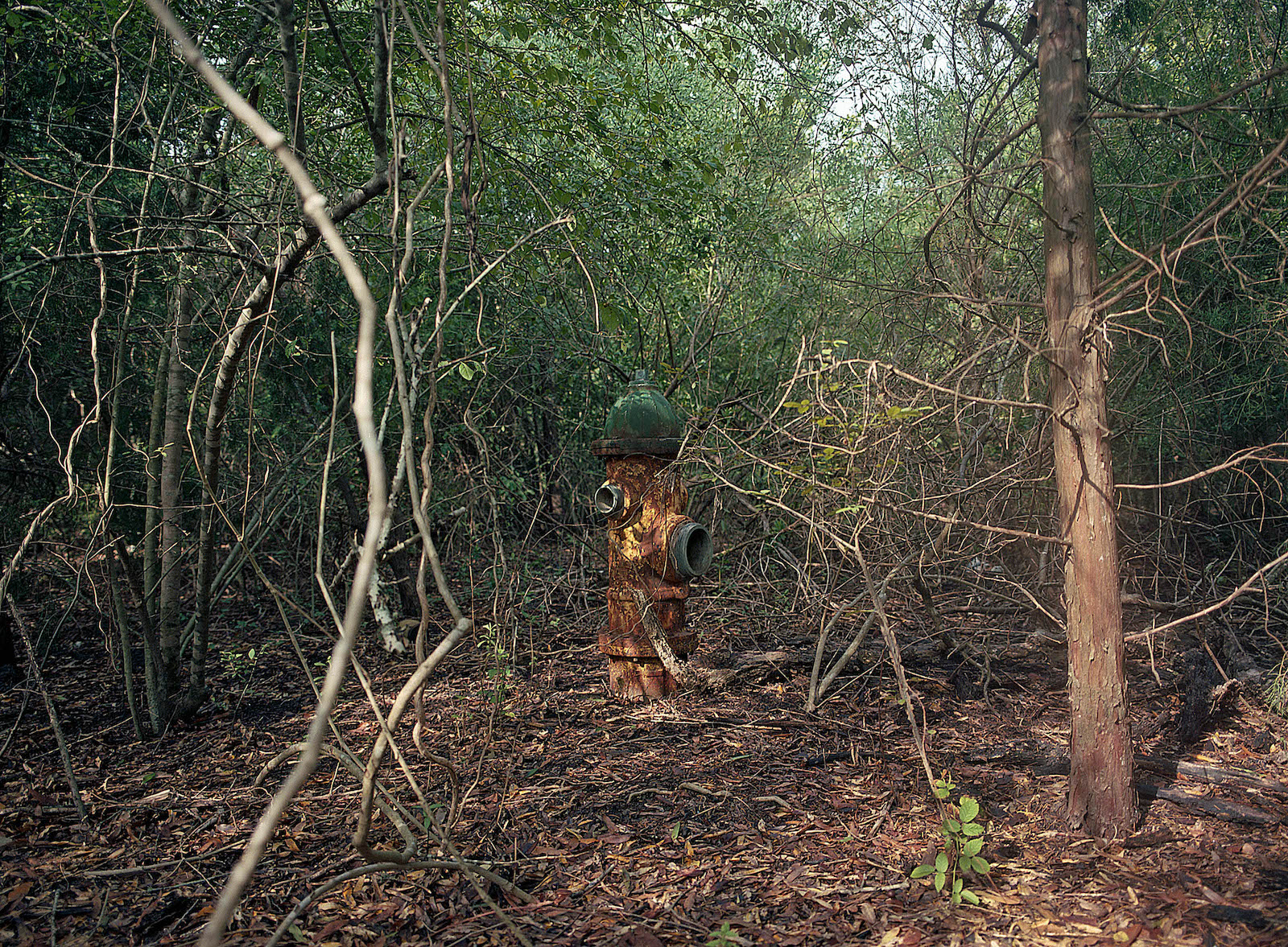
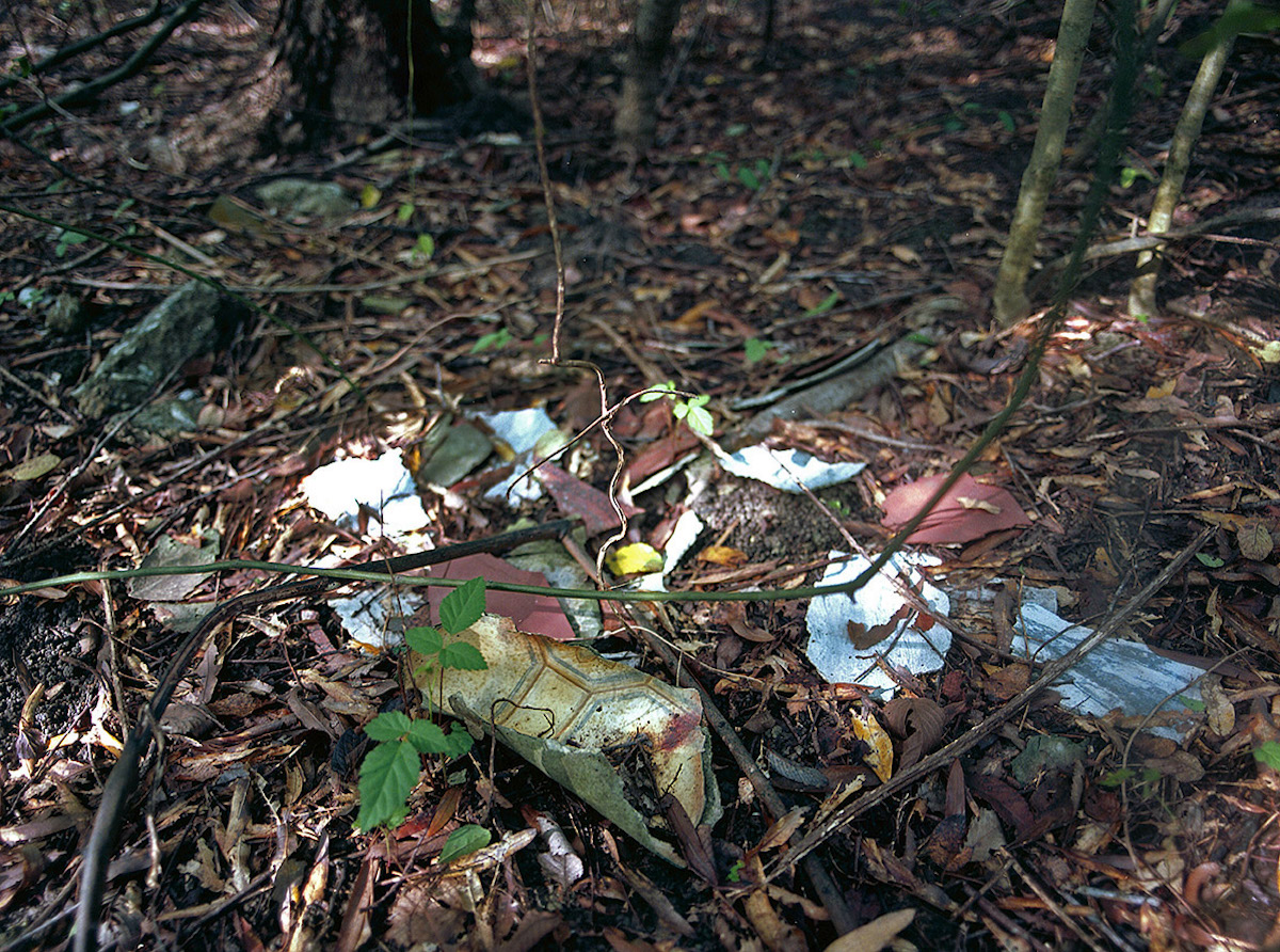
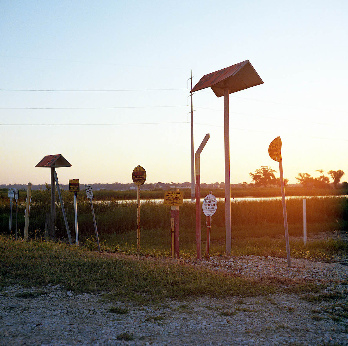
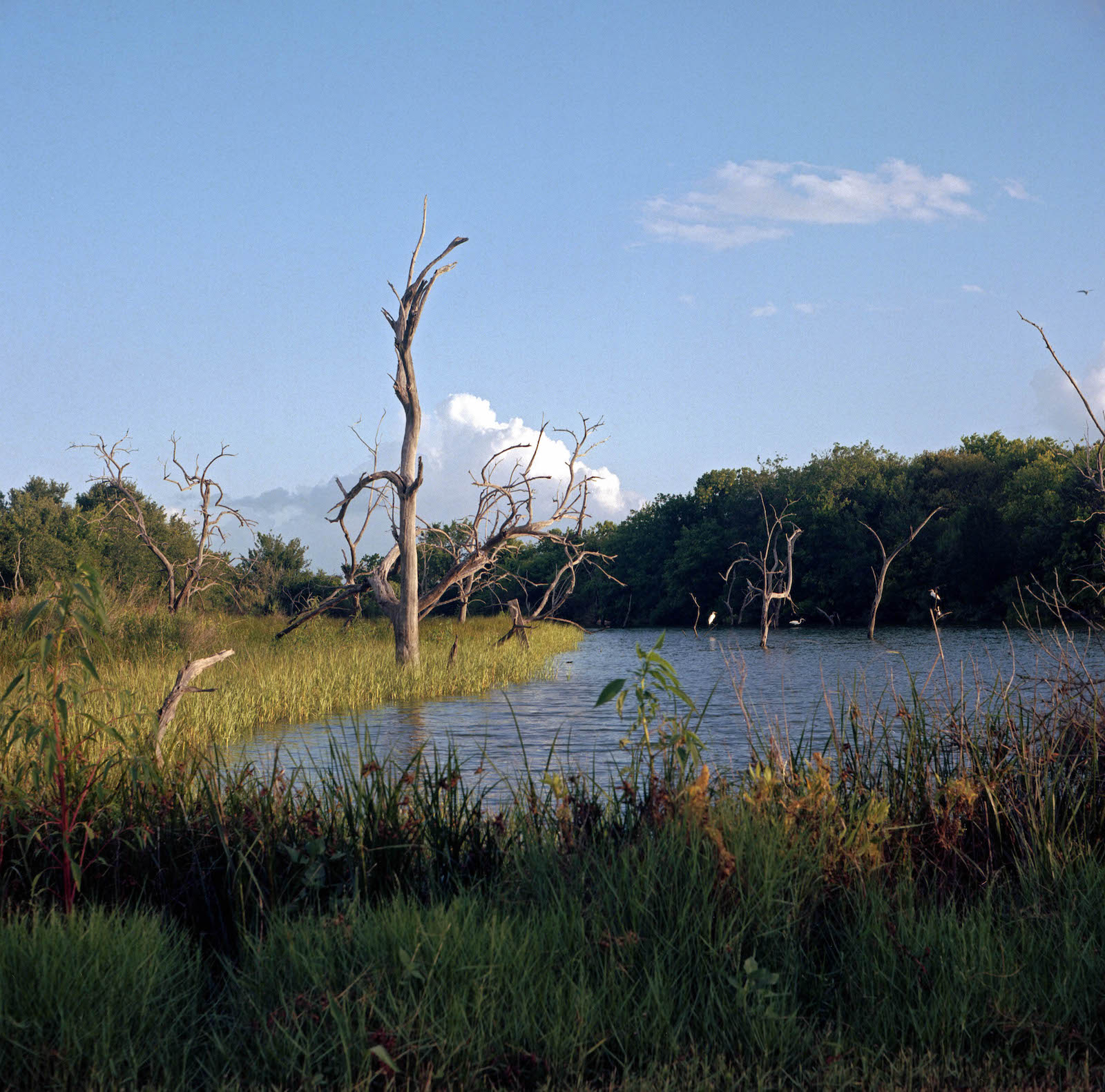
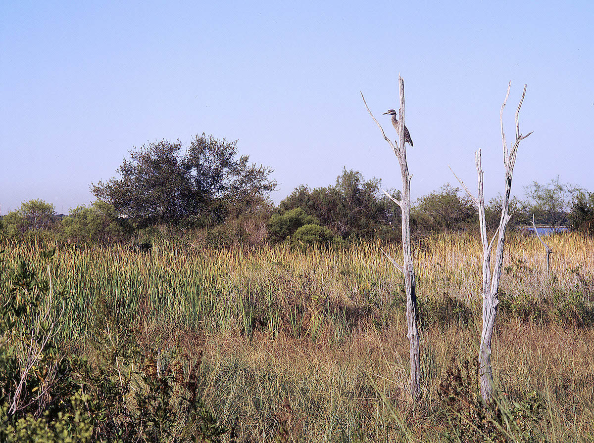
Rather than representing an idyllic return to nature, however, the site of the former subdivision also presents troubling aspects. Oil pipelines run through the nature center, and warning signs alert visitors that fish and shellfish are contaminated with dioxin and PCBs. The seagrass along the shore is littered with trash and debris washed up by tide and storm. The original subdivision roads, now crumbling, are the footpaths of nature trails. Manhole covers at regular intervals suggest the remains of sewer and drainage systems. Utility poles stand here and there, while the long arms of General Electric streetlamps hide in the underbrush. Concrete house foundations dot the nature center, some partially submerged in the surf, others mere slabs on dry land surrounded by marsh and ponds.
“Anthropocene,” the suggested name for the current geological epoch characterized by human modification of the Earth, reinforces the long-standing divide between the human and nonhuman worlds by calling attention to the ways humans have altered, damaged, and even destroyed landscapes, ecosystems, and nonhuman communities. Indeed, the Anthropocene stands as the endgame in a millennium-old contest between humans and nature—humans have won, the price of which is rising sea levels, increasingly frequent and powerful weather events, shifting and contracting bands of human habitation, and mass extinctions of flora and fauna.2
Another way of viewing the Anthropocene, following scholars such as Donna Haraway and Anna Lowenhaupt Tsing and novelists including Jeff VenderMeer, is to focus on how the new global epoch collapses the distinctions between humans and nature by turning our attention to the entanglements between the human and nonhuman worlds. Few places are untouched by human actions these days, and all landscapes are now hybrid products of both nature and culture. Places like Brownwood/Baytown Nature Center serve to remind us that human agency in the era of global climate change is defined by humans’ ability to create novel landscapes, bringing into being formations reliant on both human and nonhuman forces. Something like a ghost town, Baytown Nature Center—sitting atop the ruins of the Brownwood Subdivision—offers one view of the Gulf Coast’s potential future.3
Brownwood didn’t die an easy death. As local agriculture and industry, particularly petrochemical industry, pumped billions of gallons of water from the local aquifer, the area sank. The sinking, known as subsidence, occurs when the groundwater that underlies and permeates the sand and clay subsoil of a region is extracted. It happened over the course of decades, the land sinking five or so inches per year and becoming increasingly vulnerable to flooding. Already a low-lying coastal region, the peninsula soon faced repeated flood events. Hurricane Carla in 1961 offered the first serious sign of the growing problem, inundating many of the houses in the subdivision. But most residents rebuilt and went on.
Still, the land continued to sink, and storm-related floods led to evacuations and damage in 1967, 1969, 1970, 1971, 1973, 1977, and 1979. By the 1970s, even high tides could cause problems. Some residents gave up and moved out, turning their homes into cheap rental properties. The Army Corps of Engineers sought a solution, and the local government balked at the rising costs of maintaining the neighborhood, but it took the severe damage of Hurricane Alicia in 1983 to spell the end of the subdivision.
For those who stayed in the neighborhood between Hurricanes Carla and Alicia, ecological vulnerability built stronger community bonds. They made their own local warning system to tell each other of the “‘nuisance’ tides.” They raised the perimeter road, creating a levee and evacuation route, and installed pumping stations. They referred to their neighborhood by new names that reflected the tenuous situation—“Submarine Acres” and “Flood City, U.S.A.” Jean Shepard, who lived in Brownwood from 1954 until Hurricane Alicia forced her out, recalled that the neighborhood association shunned the typical concerns of “beautification, streetlights, [and] the year-to-year picnic.” Instead, the group “became a survival civic association,” committed to helping its members endure and rebuild as their homes sank into the bay.4
Despite the problems, many residents felt betrayed when the city condemned the subdivision. They pressured the city to allow them access to their homes, which Baytown officials eventually agreed to, though ordinances forbidding construction hindered repair efforts, and electric, sewer, and water utilities were not reconnected. For many homeowners, the buyout offers were much less than they had originally paid to purchase their homes, so they suffered two losses, one sentimental and one financial. By March 1985, at least one family—the Gillums—lingered, relying on a generator and hauled-in water. They did not want to leave. “This is my home,” Roxanne Gillum told a New York Times reporter. “I bought it and paid for it. It’s the American dream. We don’t want their money. We want to stay here and watch the sun set.” Residents sued the city and protested at City Hall, but even the Gillums eventually had to leave the subdivision.5
Once the site of a close-knit and happy community, the Baytown Nature Center is a haunted place. Former Brownwood residents at a 2002 reunion recalled that the subsidence was so bad and the storm surge of Hurricane Carla so strong that the storm exposed caskets at the Wooster Cemetery at the subdivision’s southwestern tip. As the subdivision sank over the decades, the cemetery and its upright markers had provided a reference for the rate of subsidence. It had also offered a ghostly call to action, though one that went largely unheeded. As the shoreline moved further inland, recalled one former resident, the “[t]ombstones still reached above the bay waters like the hands of drowning people before they go under for good.” Today, no sign of the cemetery remains above the water’s surface. Some of the graves were relocated. Beachcombers have found coffin handles on the shoreline, macabre reminders of the nature center’s cultural history.6
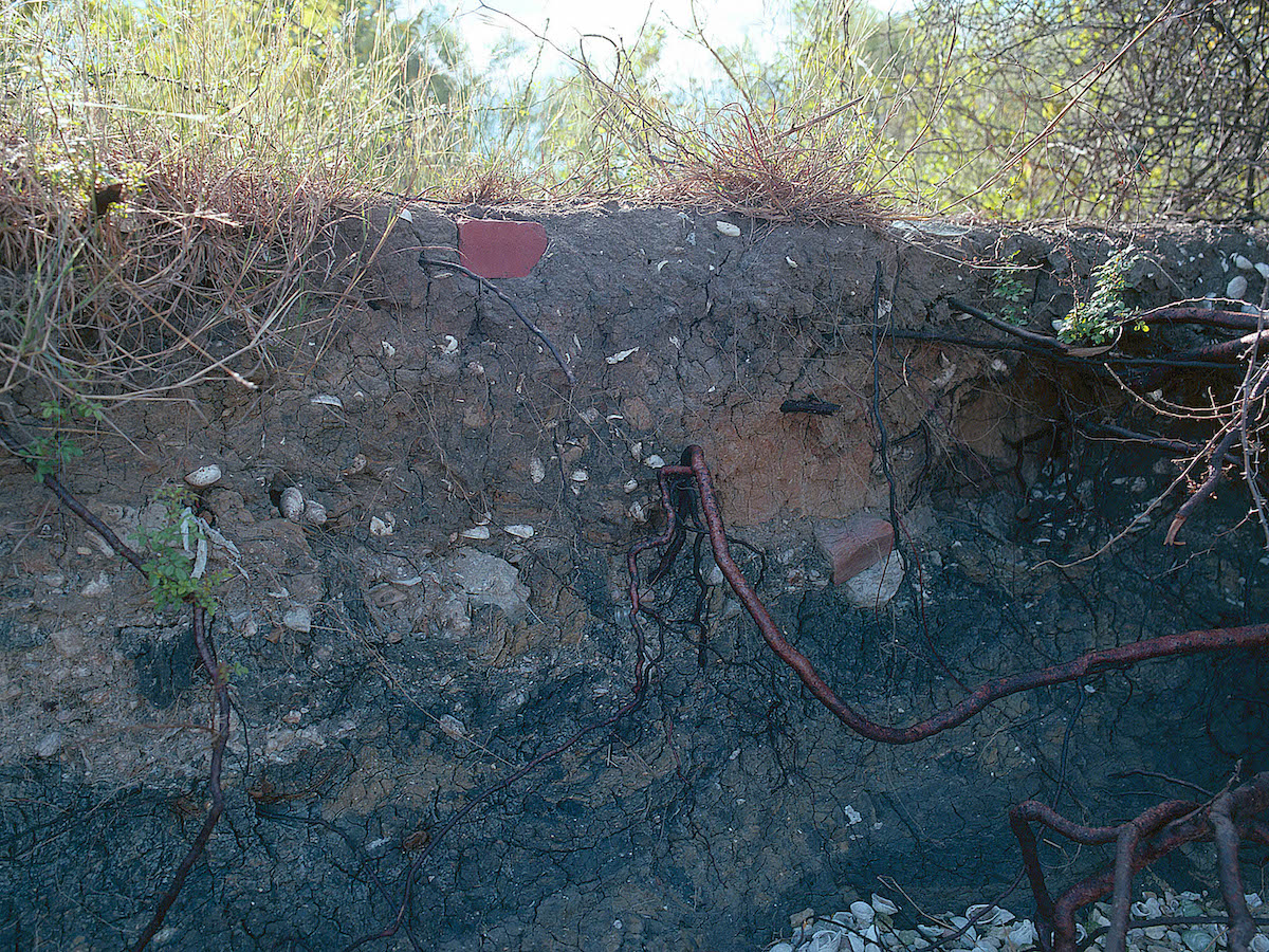
Other burials mark the site. When the city of Baytown condemned the subdivision after Hurricane Alicia and the Federal Emergency Management Agency bought out the homeowners, demolition contractors dug pits next to the ruined houses and buried 230 of them. They covered the fallen trees, concrete slabs, and other “inert” debris left by the storm—mass graves for an abandoned neighborhood. In the years since the demolition effort, coastal and surface erosion, changes in vegetation, and the continuing processes of landscape management have alternately exposed and rehidden some of that debris. Scratch almost any surface of the nature center and you’ll likely find more remains of the subdivision.7
Some visitors to the BNC interpret the place as an example of, to use journalist Alan Weisman’s phrase, “the world without us.” Or, as one person wrote on Tripadvisor, the nature center is “a great place to think of how the earth would be if man were to disappear. All these years and our footprint still remains.” An architect who studied the place agreed, writing that “Brownwood presents a concrete image of the world after mankind is gone.” The crumbling roadways, scattered debris, and remaining house foundations impart a postapocalyptic sense to the place.8
But like the former subdivision, the current nature center is a constructed space. As nonhuman forces reassert themselves, the BNC requires constant human intervention and maintenance. Decades of governmental decisions and on-the-ground work shaped both the remaining elements of the subdivision and the natural landscape features that obscure those traces. Rather than nature having replaced culture as the shaping force on the peninsula, the current landscape is the product of both human and nonhuman forces.9
The FEMA agreement under which the subdivision properties were bought out required the city to turn the area into public green space. But Baytown’s municipal budget in the late 1980s limited what could be accomplished, so, for about a decade, the peninsula sat as an abandoned neighborhood. During those years, the intermittent floods continued, and the interior of the peninsula—the area that is now the restored wetlands—became a sort of marginal and spontaneous marshland, full of residential ruins but also home to resurgent natural features. As seagrasses grew, ornamental plantings escaped their manicured lawns, and native wildlife moved in. Closed off from Baytown proper, the area also hosted a range of human activities, including fishing, illicit ATV driving, illegal dumping, and violent crime.10
By the early 1990s, the Houston region’s history of industrial contamination provided Baytown officials with a solution to their budgetary shortfalls when the principal polluting parties of the nearby French Limited EPA Superfund site—an industrial waste disposal lagoon about twenty miles from Baytown that was closed in 1973—were ordered to restore an area of wetlands as “appropriate compensation for natural resource injuries.” After an exhaustive survey of possible restoration sites, the French Limited Task Force decided on the former Brownwood Subdivision as the site of their court-ordered restoration project.11
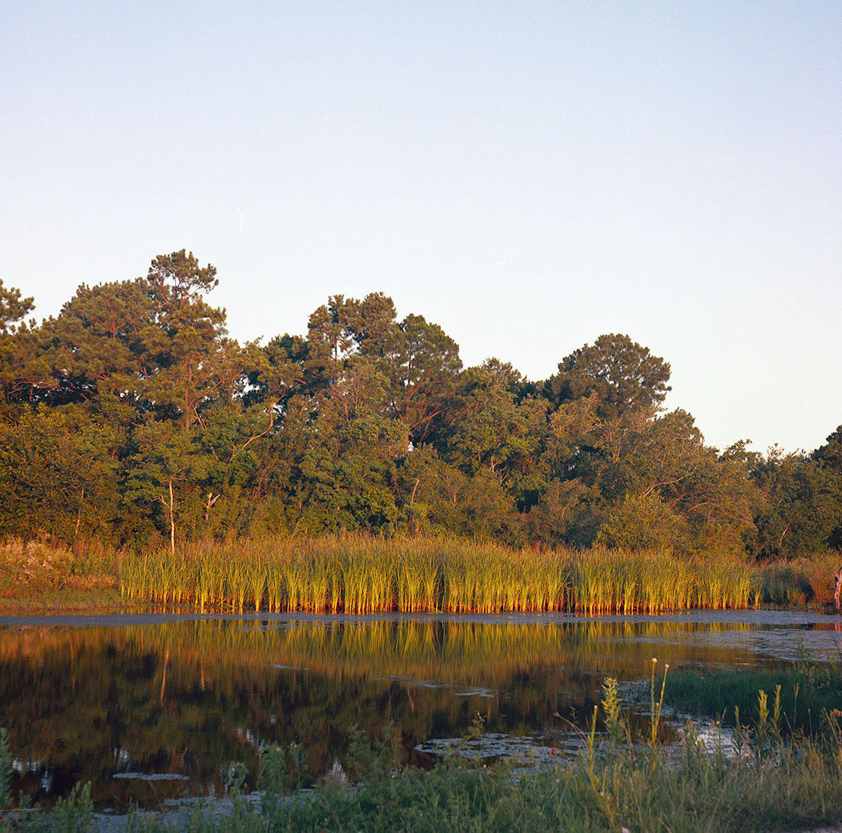
The agreement gave Baytown the means to transform the peninsula into a nature center, leading to the restoration of an initial sixty acres of wetlands constructed on the ruins of the subdivision. Designed and managed by Crouch Environmental Services, this first phase of ecological restoration saw “the creation of 40 acres of new saline marsh, 10 acres of deepwater channels allowing tidal influence from the bay, and 10 acres of forested islands supporting shallow freshwater ponds.” The peninsula’s recent history mattered for that restoration process: the decade since Hurricane Alicia had both physically shaped the land and shown planners how local residents wanted to use the space for recreation. The ecologically restored landscape opened as the Baytown Nature Center in 1995. In the years since, other companies needing to mitigate their environmental impacts have funded the creation of additional marshes, hammocks, and ponds at the site.12
Shaped by human decisions and designs, there’s very little that is “natural” about the nature center. But there is a fitting circularity in its logic: industry provided the prosperity that built the subdivision, industry drew out the groundwater and sank the neighborhood, and industry funded an ecological restoration project on the ruins of the neighborhood.
Embracing the artificial nature of the BNC suggests a path to come to terms with our Anthropocentric future because it represents a means to create and value places where the distinction between nature and culture loses significance. In its ability to create nonhuman systems and communities and human cultures oriented toward caring for nonhuman worlds, ecological restoration offers a way to heal. Philosopher Alan Holland has argued that such projects should be viewed as attempts to come to terms with loss. Reflecting on planting native wildflowers on former battlefields as a form of war remembrance, Holland suggests such plantings “achieve a meaning richer than that of any stone monument” because the flowers are “alive and dynamic.” When Brownwood sank and flooded, families lost their homes and all the possible futures that would have played out there. Perhaps, then, turning the ruins of the subdivision into a natural area—a space certainly alive and dynamic, even if man-made—also recovers some sense of what was lost, creating a new set of possible futures aimed, in Holland’s formulation, at “honoring both cultural and natural meanings.”13
At least, some former Brownwood residents felt that way. In 1997, when the city presented its twenty-year master plan for the site, which had already undergone an initial phase of ecological restoration, Jean Shepherd cried “tears of joy.” Seeing the place go from a wrecked and abandoned neighborhood to a nascent nature center led to a “catharsis 14 years in the making.” At Brownwood, ecological restoration had helped heal the displaced community while altering the landscape.14
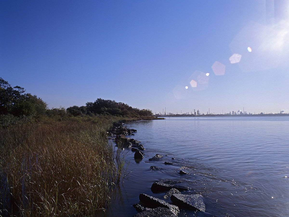
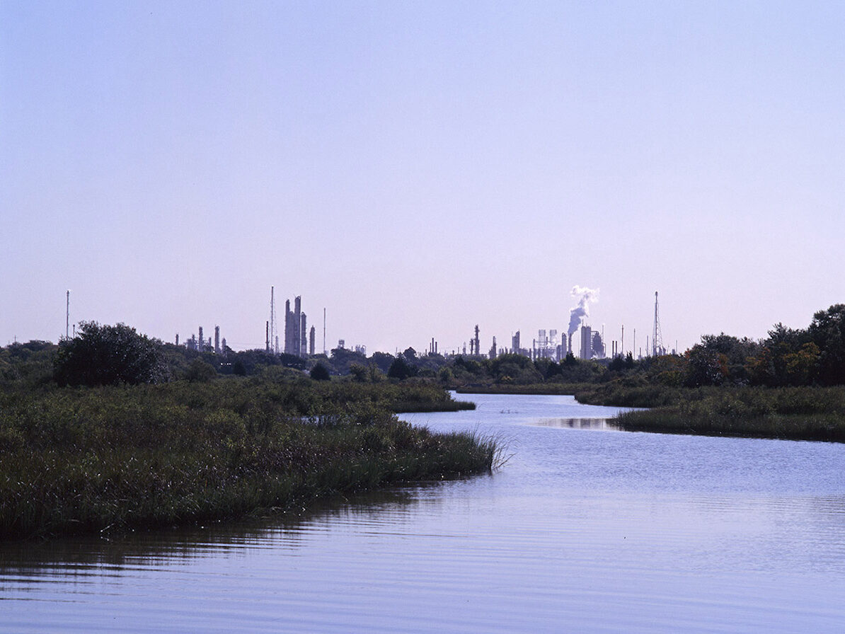
Indeed, the nature center is beautiful, and it has become an important habitat area. Forming a section of the Great Texas Coastal Birding Trail, the center hosts more than three hundred species of local and migratory birds. Rabbits, snakes, alligators, possums, and racoons call the nature center home, and the restored wetlands provide an estuary for trout, redfish, and mullet as well as shellfish and mollusks. Humans, too, enjoy the space, which offers a playground, a butterfly garden, fishing access, and miles of quiet walking trails that offer a rare sense of wilderness despite the surrounding metropolitan landscape.15
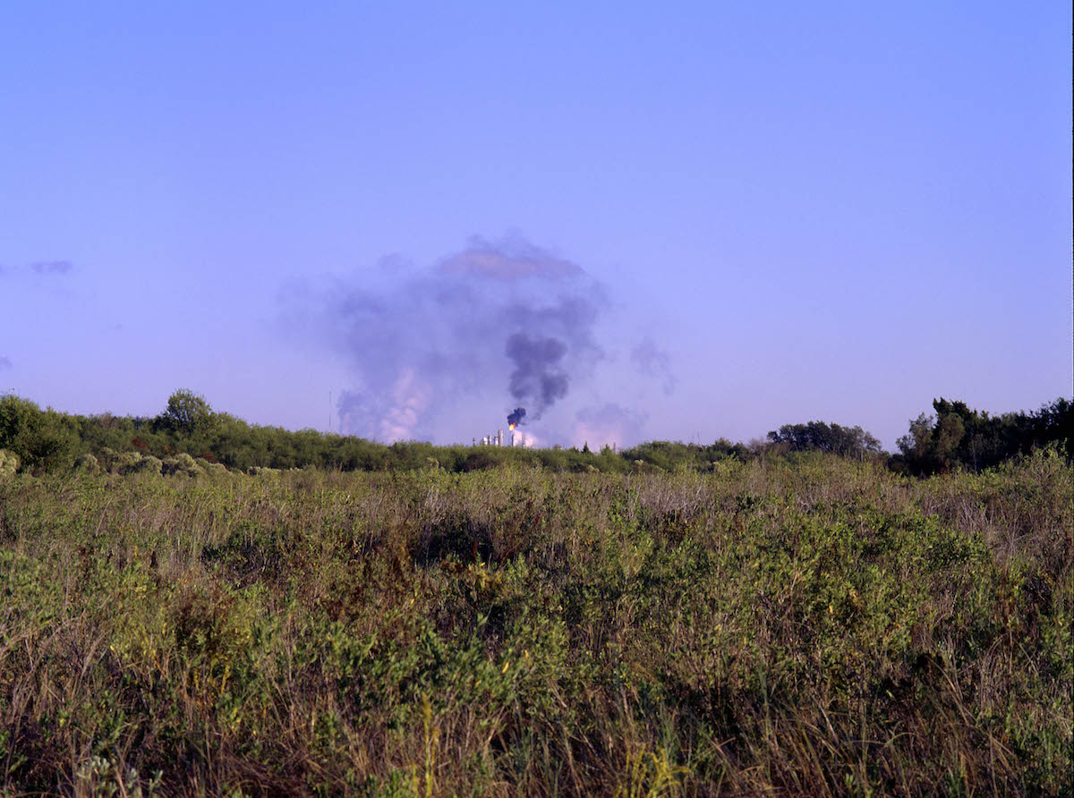
It’s not entirely clear, however, whether the human-induced resurgence of nature at Brownwood is a good thing. Critics argue that mitigation practices perpetuate environmental degradation by allowing polluting companies to purchase the ability to destroy one area by promising to restore another. But here, even the “restored” landscape is tainted by the toxic legacy of Houston-area industry. Signs along the jetties and piers of the center warn of dangerous contaminants in the water, the by-products of the petrochemical plants that surround the Baytown Nature Center. The signs tell anglers to eat no more than eight ounces of fish or crab caught there per month.
Anthropologist Anna Lowenhaupt Tsing has suggested the Anthropocene invites an orientation toward “living in the ruins.” Her study of matsutake mushroom foragers reveals a second life for over-harvested forests. Because the rare and expensive matsutake mushroom grows best in pine forests, and since pine is the fast-growing replacement of clear-cut old-growth forests, pine-timbered landscapes in the Pacific Northwest and elsewhere have increased the habitat of the matsutake. Mushroom pickers have found new ways of being amid the destructive creativity of capitalist extraction.16
But seabirds can’t read the signs at the Baytown Nature Center, and some of the people who fish there are working-class people more likely to fish for sustenance than for sport. Worse still, as of December 2020, Texas Parks and Wildlife advisories stated that “persons should not consume blue crabs or any species of fish from these waters,” citing risk of dioxins and PCBs and suggesting that area seafood is unsafe at any amount per month. What slow violence of contamination and toxic bioaccumulation accompanies the plants and animals that have returned to the ruins of the subdivision? Despite its peacefulness, it’s hard to feel at ease at the Baytown Nature Center.17
It’s also hard to know what the future holds for the area. The peninsula is a landscape in motion, and the combined effects of climate, weather, and vegetation growth will continue to hide the residential ruins. Human actions will also continue to change the area, and the longer-term process of transformation into wetlands is ongoing. In the early 2000s, four houses still stood in the defunct neighborhood and evidence of demolished structures, including bricks, shingles, and timber, was more common than it is now. As recently as 2014, drone footage revealed much more clear evidence of house foundations, swimming pools, and seawalls throughout the nature center than can be easily seen now, either in person or on recent Google Earth imagery.18
The area remains an environmental mitigation site for regional natural resource damage claims, such as the 2013 mitigation agreement for the Greens Bayou Site near Houston that created another eleven acres of wetlands at the BNC. The city of Baytown, too, remains invested in the space as a recreational site. In 2017, for instance, Baytown city manager Rick Davis said that he’d like to turn the remaining subdivision road surfaces into soft trails and construct a bike path along the perimeter of the nature center. The city also plans to construct an educational building linked to the BNC. Like Brownwood before it, the current nature center is an impermanent space. Given long enough, very little evidence of the former subdivision is likely to remain. Indeed, as sea levels rise in the next century, the entire peninsula may sink permanently into the ship channel.19
As the Gulf Coast looks toward a future of rising sea levels and continued subsidence and coastal erosion, as well as ongoing and renewed efforts to restore and rehabilitate natural areas, places like Brownwood will become more common. Such places help us think through the full range of interaction between human and nonhuman worlds and move us beyond the false dichotomy between nature and culture, a lingering distinction the age of global climate change implicitly calls into question. Coming to terms with them may help us understand the broader implications of the Anthropocene. In that sense, the Baytown Nature Center—and the subdivision on which it sits—is both unique and ubiquitous, embedded within its particular and local histories while foreshadowing and representing countless other abandoned communities and rehabilitated natural areas.
Keith McCall lives in Tallahassee, Florida, and serves as the assistant director of the Office of Graduate Fellowships and Awards at Florida State University. He has a PhD in history from Rice University, where he developed this project while serving as public humanities postdoctoral fellow at the Humanities Research Center in 2020–2021. This piece is the first installment of a longer-term project exploring the man-made and managed coastlines of the Gulf South.NOTES
- Geologists and other scholars have proposed a new geological epoch called the Anthropocene to denote a period defined by human alteration of the Earth’s ecosystems and climate. In 2016, the Anthropocene Working Group of the International Commission on Stratigraphy released a preliminary report and set of resolutions, suggesting the start date for the Anthropocene would be “optimally placed in the mid-20th century, coinciding with the array of geological proxy signals preserved within recently accumulated strata and resulting from the ‘Great Acceleration’ of population growth, industrialization and globalization.” A product of Houston’s wartime and midcentury economic growth, the development of the Brownwood subdivision was a result of the “great acceleration” and coincides with the suggested beginning of the Anthropocene, making it a prime southern space to explore local manifestations of the new global epoch. For the Working Group’s report and resolutions, see “Working Group on the ‘Anthropocene,’” Subcommission on Quaternary Stratigraphy,” May 21, 2019, https://quaternary.stratigraphy.org/working-groups/anthropocene/. For a thorough history of the subdivision, see Laura Bernal, “Brownwood: Baytown’s Most Historic Neighborhood” (master’s thesis, University of Houston, 2020).
- As originally conceived by Paul J. Crutzen and Eugene F. Stoermer in 2000, the Anthropocene, while neutrally denoting a geological epoch, was also meant to highlight the damage humans have done to natural systems through industrial society. To introduce the term, the authors emphasized the greenhouse effect from the use of fossil fuels, rising species extinction rates, damage to the ozone layer, the increased presence of toxins in the environment, and the destruction of wetlands as prime markers of humans’ impact on the Earth. They concluded that “develop[ing] a world-wide, accepted strategy leading to sustainability of ecosystems against human-induced stresses will be one of the great future tasks of mankind.” Paul J. Crutzen and Eugene F. Stoermer, “The Anthropocene,” IGPB Newsletter 41, May 2000, 17–18.
- Scholars have suggested other terms to denote this new geological epoch, including Jason W. Moore’s “Capitalocene,” Donna J. Haraway’s “Chthulucene,” and Anna L. Tsing’s (and other’s) “Plantationocene.” Jason W. Moore, ed., Anthropocene or Capitalocene?: Nature, History, and the Crisis of Capitalism (Oakland, CA: PM Press, 2016); Donna J. Haraway, Staying with the Trouble: Making Kin in the Chthulucene (Durham, NC: Duke University Press, 2016); Gregg Mitman, “Reflections on the Plantationocene: A Conversation with Donna Haraway and Anna Tsing,” Edge Effects, June 18, 2019. While Brownwood’s historical entanglements with oil extraction and processing make it a site deeply implicated in the relations that Moore uses to explore the idea of the Capitalocene, I prefer to interpret the space as representing the Anthropocene because the peninsula’s history as both a subdivision and a nature center has focused on anthropocentric uses and values; even in its current form as a nature center, the site privileges human uses and relies on human interaction and maintenance.
- Baytown Sun (Baytown, TX), September 8, 1996, 4; Bernal, “Brownwood,” 159. Jean Shepard said the most notable aspect of the neighborhood in those years was its sense of “cohesiveness” derived from shared struggle. Jean Shepard, “Brownwood Subdivision Reunion Part 1,” Sterling Municipal Library, March 6, 2014, YouTube video, 0:6:30–0:7:15,https://www.youtube.com/watch?v=vJvIBAYHQpI.
- “Deluge Washed Out One Neighborhood,” New York Times, March 31, 1985, 22.https://www.nytimes.com/1985/03/31/us/deluge-washed-out-one-neighborhood.html.
- Charles Lockwood, “From Subdivision to Sanctuary,” Planning 62, no. 10 (October 1996): 13; Trevia Wooster Beverly, “An Application for an Official Texas Historical Marker for Wooster,” 7; “Wooster Cemetery,” Baytown, Harris Co. Cemeteries of TX, accessed April 18, 2022, https://www.cemeteries-of-tx.com/Etx/Harris/cemetery/wooster.htm. Carol McCullah recalled the “old graveyard” as one of her favorite places in the subdivision, and she noted the exposed caskets following Hurricane Carla. Carol McCullah, “Brownwood Subdivision Reunion Part 1,” Sterling Municipal Library, March 6, 2014, YouTube video, 1:20:55–1:21:20. Another resident, W. C. Smith, recalled that he “discovered” the cemetery while playing on the beach near where he lived at Mapleton Avenue and Bayshore Drive, suggesting that, in the early 1970s, the cemetery was not a well-marked site. Smith said the cemetery was “about to go under water” when he found it. W. C. Smith, “Brownwood Subdivision Reunion Part 1,” Sterling Municipal Library, March 6, 2014, YouTube video, 0:02:30–0:03:30, https://www.youtube.com/watch?v=vJvIBAYHQpI.
- An archaeological survey of the area in 1994 determined that the demolition of the subdivision—specifically the process of burying the demolished houses—had resulted in “radical alteration of the landscape.” Roger G. Moore, An Archaeological Survey of a French Ltd., Wetlands Replacement Project, City of Baytown, Harris County, Texas (Houston: Moore Archeological Consulting, 1994), 6–7; T. D. Garcia, “Subsidence and Surface Faulting at San Jacinto Monument, Goose Creek Oil Field, and Baytown, Texas,” Field Trip Guidebook on Environmental Impact of Clays along the Upper Texas Coast (Houston, TX: Lunar and Planetary Institute, 1991), A39, https://articles.adsabs.harvard.edu//full/1991LPICo.773A..33G/A000036.000.html.
- Alan Weisman, The World without Us (New York: Picador, 2007); Paul S. Sutter, “The World with Us: The State of American Environmental History,” Journal of American History 100, no. 1 (June 2013): 99; “Karen M.,” 2013, Tripadvisor.com; Larry Albert, “Houston Wet,” (master’s thesis, Rice University, 1997), 22.
- In being so explicitly shaped by both natural and cultural processes, the Baytown Nature Center is a prime example of a “hybrid landscape,” a term environmental historians use to discuss the inseparability of humans and nature as agents of historical change. Richard White, “From Wilderness to Hybrid Landscapes: The Cultural Turn in Environmental History,” Historian 66 (Fall 2004): 557–64; Sutter, “World with Us,” 94–119. Scholars also use the term “layered landscape” to describe places “where human and natural histories intertwine over time.” Marion Hourdequin and David G. Havlick, eds., Restoring Layered Landscapes: History, Ecology, and Culture (New York: Oxford University Press, 2016), 2.
- W. C. Smith lived on the eastern border of the subdivision in the 1980s and 1990s (and thus not in the condemned section) and routinely encountered both illegal dumpers and intoxicated people. He called the subdivision, during that period, “an unsupervised four hundred acres.” Smith, “Brownwood Subdivision Reunion Part 1,” 0:04:00–0:05:15. The crime reports from the BaytownSun during the same period corroborate Smith’s recollections.
- “Superfund Site: French, Ltd. Crosby, TX Redevelopment,” accessed April 18, 2022, https://cumulis.epa.gov/supercpad/SiteProfiles/index.cfm?fuseaction=second.redevelop&id=0602498; “French Limited Wetlands Mitigation: Final Site Restoration Plan,” (Crouch Environmental Services, 1994), in Freshwater Conservation Branch Project Files, 1984–2000, Texas Parks and Wildlife Department, Resources Protection Division, box 2008/038-3, Texas State Library and Archives Commission (hereafter box 2008/038-3). The search for a suitable restoration site took about five years, from a preliminary search in 1989 to the final agreement with the city of Baytown in 1994. FLTG Incorporated (Crosby, Texas)-Natural Resource Mitigation Preliminary Wetlands Site Selection Assessment, October 4, 1989, box 2008/038-3; French Limited Wetlands Mitigation-Site Selection Study (Visuals), January 27, 1994, box 2008/038-3; Baytown Sun, March 25, 1994, 1.
- “Superfund Site: French, Ltd. Crosby, TX Redevelopment”; “Brownwood Marsh Restoration Project,” Crouch Environmental Services, accessed April 18, 2022, https://crouchenvironmental.com/projects/brownwood-marsh-restoration-project/; American Institute of Architects, Regional Urban Design Assistance Team, “Baytown R/UDAT,” 1990, 58–62.
- Alan Holland, “Nature and Our Sense of Lost,” in Restoring Layered Landscapes: History, Ecology, and Culture, ed. Marion Hourdequin and David G. Havlick (New York: Oxford University Press, 2016), 69, 67.
- Baytown Sun, June 11, 1997, 4. The nature center also serves the practical purpose of flood mitigation by protecting Baytown from storm surges, perhaps adding to its role in healing the community, since it now functions to protect others from the fate that befell the subdivision’s residents.
- “Baytown Nature Center Bird Survey,” Houston Audubon, accessed April 18, 2022, https://houstonaudubon.org/birding/bird-surveys/baytown-nature-center.html.
- Anna Lowenhaupt Tsing, The Mushroom at the End of the World: On the Possibility of Life in Capitalist Ruins (Princeton University Press, 2015).
- “Fishing Consumption Bans and Advisories,” Houston/Galveston Area, Texas Parks and Wildlife, accessed April 18, 2022, https://tpwd.texas.gov/regulations/outdoor-annual/fishing/general-rules-regulations/fish-consumption-bans-and-advisories; Rob Nixon, Slow Violence and the Environmentalism of the Poor (Cambridge, MA: Harvard University Press, 2011). Dioxin and PCBs can cause a variety of serious health hazards ranging from neurological disorders to cancer to damage to reproductive systems. Birds and mammals that eat PCB- or dioxin-contaminated fish and shellfish tend to have a higher concentration of the toxins, which are stored in fatty tissues and accumulate over time. For the effects of dioxins, see Sally S. White and Linda S. Birnbaum, “An Overview of the Effects of Dioxins and Dioxin-line Compounds on Vertebrates, as Documented in Human and Ecological Epidemiology,” Journal of Environmental Science and Health 27, no. 4 (October 2009): 197–211.
- T. Lindsay Baker, More Ghost Town of Texas (Norman: University of Oklahoma Press, 2001), 22; Richard B. Mahoney, Roger G. Moore, and Sue Winton Moss, Cultural Resource Investigations and Archeological Inventory of the Baytown Nature Center Park, City of Baytown, Harris County, Texas (Moore Archeological Consulting, 1999), 29–32, 37–38; “Brownwood Feb 2014 Drone Aerial – RAW,” Steve Rowell, April 7, 2014, Vimeo video, 5:04, https://vimeo.com/91347993.
- “Trustees Settle Natural Resource Damage Claims Arising from Hazardous Substances Releases at Greens Bayou Site, Harris County, Texas,” US Department of the Interior, last modified September 25, 2020, https://www.doi.gov/node/17082; Christopher James, “Baytown booming – 5 Years Down the Road,” Baytown–West Chambers County Economic Development Foundation, August 20, 2017, https://baytownedf.org/news-media/article/baytown-booming-5-years-down-the-road.